News facts
This summer, climate change impacts across Eastern Europe and the Caucasus have been hard to ignore. Record heatwaves and drought pushed the Danube to historic lows, straining water availability and hydropower generation, while wildfires swept across North Macedonia, Serbia, Bosnia and Herzegovina, Albania and beyond. Wildfires, drought and growing pressure on water resources do not stop at borders, and neither should the response. Across the region, countries are finding new ways to build resilience, share solutions and act together.
Technology has become an inevitable part of this response. Over the past decade, CTCN has worked across the region to help countries better understand climate risks, anticipate what comes next and act earlier. This journey stretches from vulnerability assessments and flood modelling to wildfire forecasting, AI and drones, to help turn climate knowledge into action.
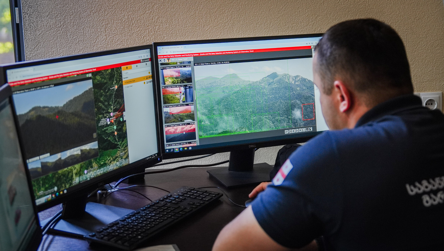
Photo credit: CTCN / Miranda Tasker
Building the evidence for resilience
Countries cannot plan effectively for climate change without understanding where their vulnerabilities lie.
In Azerbaijan, CTCN support in 2020 helped address gaps in climate information and bring greater consistency constituency to climate vulnerability assessments, particularly in the country’s mountain regions.
The assistance helped local stakeholders and national experts develop vulnerability and impact indicators, pilot their application, and strengthen the use of turning climate information into better investment decisions. The work strengthened evidence-based planning at national and municipal levels and created approaches that could be scaled up and integrated into broader adaptation planning.
That shift from climate evidence into action continued in Georgia.
Mapping the flood before the next disaster
Flash floods and mudflows are a serious risk in Tbilisi. After the devastating 2015 Vere River flood, the question was how to better prepare for the next extreme event. Attention turned to the nearby Dukniskhevi River, where another major floor could put communities and infrastructure at risk.
CTCN technical assistance helped turn that risk into something the authorities could see and plan for. Hydrological and hydrodynamic modelling, field surveys and detailed flood hazard and risk maps showed where water could flow, and which areas were most exposed. In collaboration with HYDROC, CTCN also examined bridges, tunnels and piped river sections and identified options for better monitoring, flood forecasting and early warning.
The knowledge and expertise stayed in Georgia. Training and technology transfer equipped national experts to conduct similar modelling themselves, leaving Georgia with the skills and tools to assess future flood risks, plan adaptation measures and make better-informed decisions about how the city develops.
Nearly a decade later, the same principle – seeing a hazard earlier so that authorities can act sooner – is taking a new technological form in the region.
When seconds matter
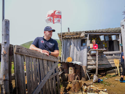
Borjomi-Kharagauli National Park is one of Georgia’s natural treasures with more than 42,000 hectares of forest supporting wildlife, local livelihoods, tourism and water resources.
But hotter, drier conditions are increasing wildfire risks, while historically late detection has allowed some fires to become devastating. Between 2007 and 2021, more than 600 recorded fires burned around 7,244 hectares of Georgian forest.
Now, new technology is changing how fires can be detected.
With support from CTCN through the Adaptation Fund Climate Innovation Accelerator (ACFIA), and implemented by the International Business and Economic Development Center, a new early-warning system is watching over the forest 24 hours a day. Solar-powered cameras on mountain peaks scan smoke, while artificial intelligence can identify signs of smoke and send alerts within seconds, and satellite connections link the system with Georgia’s emergency and environmental authorities.
Once smoke is detected, an alert appears on a digital map and firefighters receive an SMS, helping them locate and respond to a potential fire quickly. Long-range drones extend that reach in remote terrain, while a centralised mapping platform brings information together to provide responders with a real-time picture of what is happening.
This extra time matters not only for firefighters, but for people who rely on the forest. Local communities depend on the forest for grazing, fuelwood, beekeeping and the collection of mushrooms, herbs and medicinal plants. Tourism businesses depend on the landscape that draws visitors to the region.
Today, the technology protects ecosystems, incomes, water resources and communities.
From reacting to wildfires to anticipating them
In North Macedonia, the need to stay one step ahead of wildfires is especially urgent. This July, the country declared a nationwide crisis as the risk of forest and open-space fires intensified.

Dr. Stevko Stefanoski, Head Of Department for Risk analysis, risk assessment and Strategic planning, Crisis Management Center, during the project kick-off meeting in Skopje, North Macedonia, January 2026; Photo credit: CTCN / Valentin Rudloff
This challenge is not new, but it’s growing. Forest area damaged by fire increased tenfold between 2014 and 2021, from 11.5 to 114.2 square kilometres. North Macedonia had already taken an important step by establishing the Macedonian Forest Fire Information System (MKFFIS), designed to support wildfire prevention and preparedness.
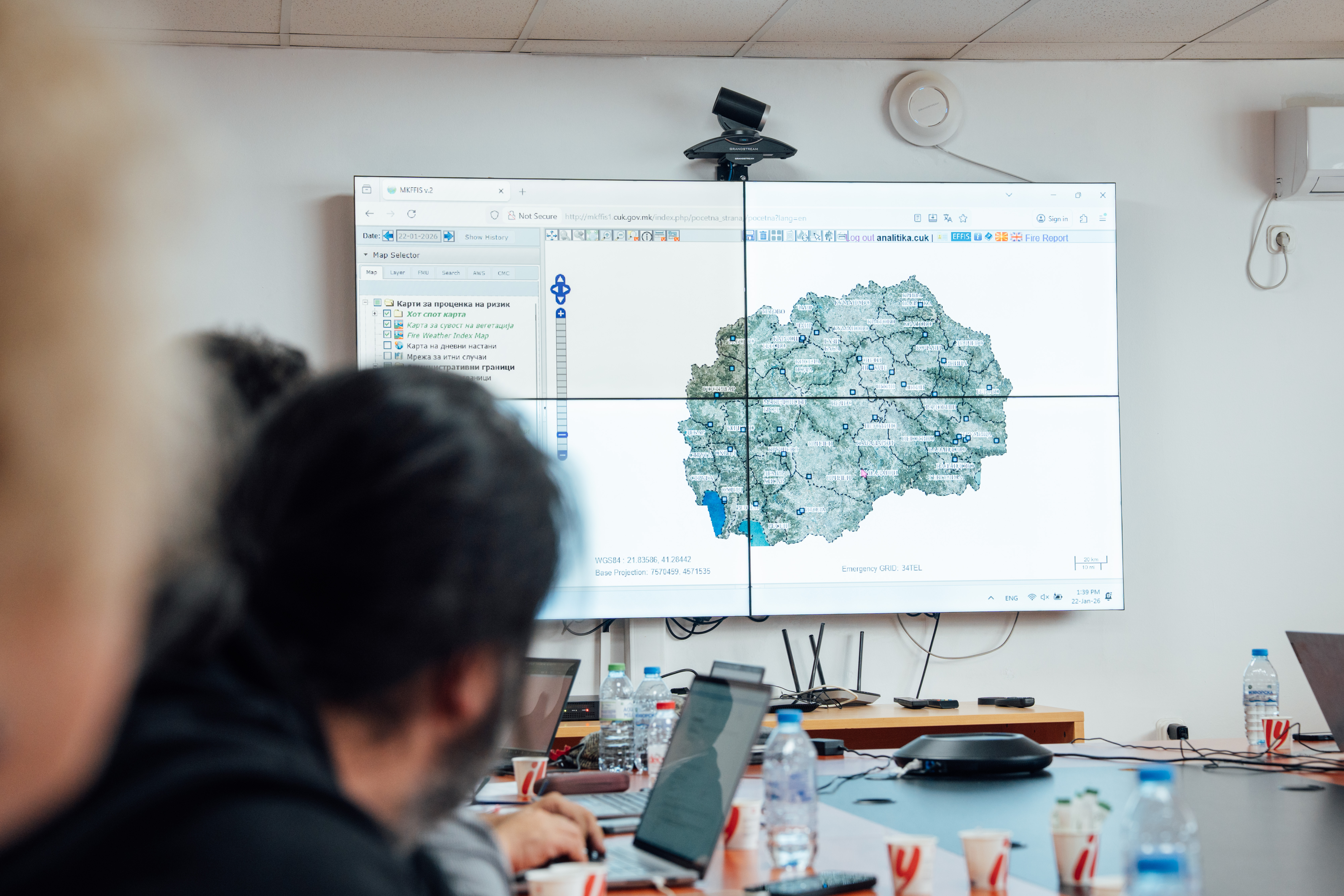
Now, CTCN’s ongoing technical assistance is helping take that system a step further. New information modules are planned to strengthen its ability to map fire hazards, assess damage and forecast how fires could develop.
However, the technology is only part of this journey. A training designed within this assistance will help officials use the new tools and turn outputs into decisions on the ground.
For a country facing another difficult fire season, that ability to anticipate what comes next matters. The aim is simple: better information, earlier decisions and more time to act.
A regional journey from information to action
Taken together, these projects show how climate technology in Eastern Europe and the Caucasus is moving from understanding risk to acting on it.
In Azerbaijan, vulnerability assessments helped inform adaptation investments. In Tbilisi, flood modelling and risk maps strengthened preparedness. In Georgia’s Borjomi-Kharagauli National Park, AI, cameras and drones are turning early warning into early action. And in North Macedonia, digital forecasting will improve wildfire readiness.
The technologies may differ, but the direction is clear: understand risk, anticipate hazards, act earlier.
And technology alone is not enough. By combining new tools with local expertise, training and stronger institutions and communities, countries are building the capacity to manage future risks themselves.
As we head towards the NDE Eastern Europe Forum, this is an important moment to take stock of that progress, share what is working and look ahead to where climate technology cooperation can make the greatest difference. After a decade of cooperation, the region has a strong foundation to build on – and an opportunity to accelerate the journey from climate risk to climate preparedness.